
More than one hundred wildland fires burn across northwestern Ontario.
Twenty-nine new ones were identified on Sunday.
Most were small in size.
The largest are three separate fires within Wabakimi Provincial Park, each covering 100 hectares or more.
The fires reported and their status as of Sunday night were;
- Fort Frances 34 (FOR034) is located approximately 1 kilometre east of Baldwin Lake and 4.5 kilometres west of Respite Lake. The 0.5-hectare fire is not under control.
- Fort Frances 35 (FOR035) is located on an island in Gargoyle Lake, approximately 1.5 kilometres north of Pinecone Lake Road. The 0.5-hectare fire is not under control.
- Dryden 30 (DRY030) is located northwest of Lower Moosehide Lake, near Berglund Road. The 0.1-hectare fire is not under control.
- Dryden 31 (DRY031) is located approximately 10 kilometres east of Highway 502, between Washeibemaga Lake and Long Lake River. The 0.2-hectare fire is not under control.
- Red Lake 23 (RED023) is located approximately 3.0 kilometres southwest of the community of McDowell Lake First Nation. The 50.0-hectare fire is not under control.
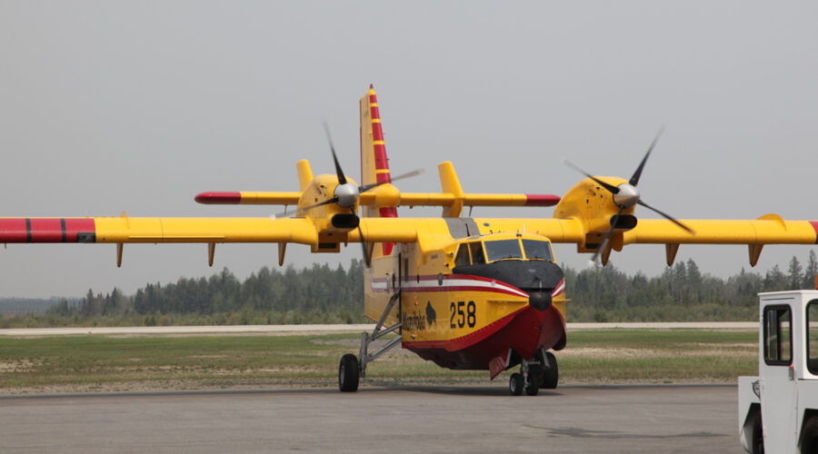
- Nipigon 34 (NIP034) is located near the south side of Toronto Lake, approximately 14 kilometres north of Auden. The 1.0-hectare fire is not under control. CL-415 waterbombers provided aerial suppression support on the fire.
- Sioux Lookout 74 (SLK074) is located approximately 6.5 kilometres northeast of Osnaburgh Lake, near Povey Lake. The 1.0-hectare fire is not under control.
- Sioux Lookout 75 (SLK075) is located approximately 3.0 kilometres south of Rat Rapids, between Doghole Bay and Highway 599. The 0.6-hectare fire is being held.
- Sioux Lookout 76 (SLK076) was located near the shore of Lake St. Joseph, south of Doghole Bay, approximately 5 kilometres west of the Albany River South Channel. The fire was called out at 0.1 hectares.
- Sioux Lookout 77 (SLK077) is located near the north shore of Lake St. Joseph, between Twiname Bay and Searson Bay. The 0.3-hectare fire is being held.
- Sioux Lookout 78 (SLK078) is located approximately 10.5 kilometres east of Highway 599, south of Pashkokogan Lake. The 0.3-hectare fire is not under control.
- Sioux Lookout 79 (SLK079) is located approximately 11 kilometres west of Highway 599, between Doran Lake and Metcalf Lake. The 1.0-hectare fire is being held. CL-415 waterbombers provided aerial suppression support on the fire.
- Sioux Lookout 80 (SLK080) is located approximately 2.5 kilometres east of Highway 599, approximately 6 kilometres south of Rat Rapids. The 0.6-hectare fire is not under control. CL-415 waterbombers provided aerial suppression support on the fire.
- Sioux Lookout 81 (SLK081) is located approximately 11 kilometres west of Highway 599, near Miniss Lake. The 0.1-hectare fire is under control.
- Sioux Lookout 82 (SLK082) is located approximately 8.5 kilometres east of Achapi Lake. The 85.0-hectare fire is being observed.
- Sioux Lookout 83 (SLK083) is located approximately 30 kilometres northeast of Achapi Lake, near Coulas Lake. The 15.0-hectare fire is being observed.
- Thunder Bay 36 (THU036) and Thunder Bay 37 (THU037) are located in a remote area of Wabakimi Provincial Park, approximately 14 kilometres northeast of Wabakimi Lake, west of Berg River. The two fires measure 100.0 hectares each and are not under control.
- Thunder Bay 38 (THU038) and Thunder Bay 39 (THU039) are located in a remote area of Wabakimi Provincial Park, between Davies Lake and Redman Lake. The two fires measure 8.0 hectares each and are not under control.
- Thunder Bay 40 (THU040) is located in a remote area of Wabakimi Provincial Park, approximately 6 kilometres west of Scrag Lake. The 0.5-hectare fire is not under control.
- Thunder Bay 41 (THU041) and Thunder Bay 42 (THU042) are located in a remote area of Wabakimi Provincial Park, southwest of Burntrock Lake. The two fires measure 3.0 and 0.5 hectares, respectively and are not under control.
- Thunder Bay 43 (THU043) was located approximately 1 kilometre west of the intersection of Penny Road and Third Road. The fire was called out at 0.1 hectares.
- Thunder Bay 44 (THU044) is located in a remote area of Wabakimi Provincial Park, approximately 4 kilometres east of Grayson Lake, northwest of Whitewater Lake. The 0.2-hectare fire is not under control.
- Thunder Bay 45 (THU045) is located in a remote area of Wabakimi Provincial Park, approximately 5 kilometres north of Grayson Lake. The 181.0-hectare fire is not under control.
- Thunder Bay 46 (THU046) is located in a remote area of Wabakimi Provincial Park, approximately 1 kilometre northwest of Sollows Lake. The 0.2-hectare fire is not under control.
- Thunder Bay 47 (THU047) is located in a remote area of Wabakimi Provincial Park, approximately 8 kilometres west of Grayson Lake. The 3.0-hectare fire is not under control.
- Thunder Bay 48 (THU048) is located approximately 7 kilometres east of Greenbush Lake, west of Rockcliff Lake. The 0.5-hectare fire is not under control.
Of the fires still active, 32 are not under control, with 59 observed and no action being taken as they pose no threat to the public or property.
High temperatures have pushed the forest fire hazard to high and extreme levels in many areas to the west and north of Thunder Bay.
It is listed as moderate in areas to the east of Thunder Bay.