

Environment Canada has issued a snowfall warning for areas north of Dryden, with significant snowfall expected tonight through Friday morning. Total snow accumulations are forecasted to be between 15 to 20 cm, with the heaviest snowfall occurring overnight at rates of 2 to 4 cm per hour.
In addition to the heavy snowfall, strong northerly winds gusting up to 60 km/h on Friday may result in blowing snow, leading to reduced visibility and potentially hazardous travel conditions.
The snow will move in from Manitoba this evening and is expected to lighten by Friday afternoon.
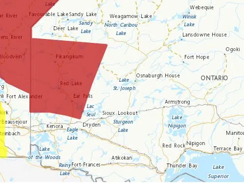
A map showing areas north of Dryden under a snowfall warning which is calling for up to 25 cm of snow starting Thursday evening. Photo: Environment Canada.
Drivers are urged to adjust their travel plans and be prepared for rapidly changing road conditions.